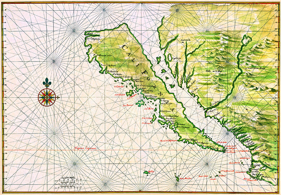
Detailed Map of California as an Island early 17th Century Includes San Francisco San Diego Monterey

by Peter Ogden
Title
Detailed Map of California as an Island early 17th Century Includes San Francisco San Diego Monterey
Artist
Peter Ogden
Medium
Painting - Ink And Watercolor On Paper
Description
This is a restored copy of an early map of Spanish California depicted as an island. The original map by Dutch cartographer Johannes Vingboons, 1616-1670 was ink and color on paper created circa 1650. The map has great,clear detail and includes the very early Spanish colonial outposts of Santa Barbara, Monterey, Pt. Reyes, San Francisco, Catalina Island ["Cata Lyn"] and San Diego ['S. Digio"]. There is little sign of coastal California north of Marin County; there is no indication of Los Angeles.
The first European explorers, flying the flags of Spain and of England, sailed along the coast of California from the early 16th century to the mid-18th century, but no European settlements were established. The most important colonial power, Spain, focused attention on its imperial centers in Mexico and Peru. Confident of Spanish claims to all lands touching the Pacific Ocean (including California), Spain sent an exploring party sailing along the California coastline. The California seen by these ship-bound explorers was one of hilly grasslands and wooded canyons, with few apparent resources or natural ports to attract colonists.
The other colonial states of the era, with their interest on more densely populated areas, paid limited attention to this distant part of the world. It was not until the middle of the 18th century that both Russian and British explorers and fur traders began establishing stations on the coast.
in 1697 the Viceroy Duque de Linares along with the Conde de Miravalle and the treasurer of Acapulco (Pedro Gil de la Sierpe) financed Jesuit expansion into California. The Duque de Linares lobbied the Spanish Crown in 1711 to increase trade between Asia, Acapulco and Lima. It is possible that Baja California Sur was used as a stopping point for unloading contraband on the way back from Manila to Acapulco. The contraband might then have been shipped across the Gulf of California to enter mainland Mexico by way of Sonora, where the Jesuits also had missions and sympathies for their financial backers.
In 1697 the Jesuit missionary Juan María de Salvatierra established Misión de Nuestra Señora de Loreto Conchó, the first permanent mission on the Baja California Peninsula. Spanish control over the peninsula, including missions, was gradually extended, first in the region around Loreto, then to the south in the Cape region, and finally to the north across the northern boundary of present-day Baja California Sur. A total of 30 Spanish missions in Baja California were established.
Uploaded
January 20th, 2020
Embed
Share
Comments
There are no comments for Detailed Map of California as an Island early 17th Century Includes San Francisco San Diego Monterey. Click here to post the first comment.


